Is Mount Baker a hazard for Canada?
Table of contents
Overview
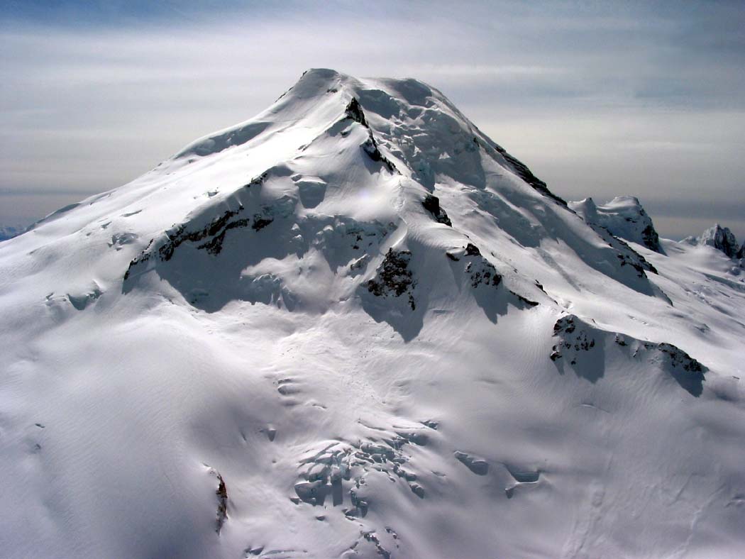
Although there are several potentially active volcanoes in southwest British Columbia, Mount Baker, 23 km south of the Canada – United States border in Washington state, is the closest volcano to the population centres of British Columbia’s Lower Mainland and Vancouver Island. On a clear day, the ice-covered peak of Mount Baker, 3286 m high, is prominent on the horizon of southwest British Columbia.
Mount Baker is a stratovolcano, constructed over many thousands of years from a mixture of lava and volcanic debris. Like other stratovolcanoes, it has the potential for both explosive and non-explosive eruptions. Mount Baker also has the potential for landslides, debris flows, and lahars (volcanic mudflows and debris flows) because it possesses steep terrain, fractures, and a groundwater system, and is built of rock weakened by hot water and steam.
What has happened at Mount Baker in the past?
Most of the Mount Baker we see today formed 10,000-40,000 years ago. Rocks from the last 14,000 years show that Mount Baker hasn’t had many large explosive eruptions like those of Mount St. Helens, nor has it erupted as frequently. Only four periods of magmatic activity (eruptions of fresh lava and not just steam) have occurred. The last big eruption occurred about 6000 years ago and scattered volcanic ash (tiny particles of shattered rock) 70 km to the northeast, but most eruptions at Mount Baker have been less extensive.
The earliest historical eruption of Mount Baker was a small explosion in 1943 that spread ash nearby. Several steam explosions also took place in the mid-1800s.
Debris avalanches, debris flows, and lahars
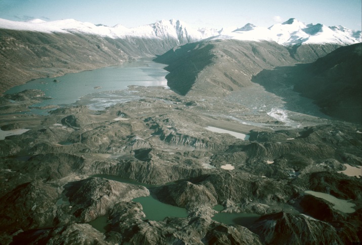
a debris avalanche
Debris avalanche deposit resulting from the May 18, 1980 eruption of Mount St. Helens, Washington. United States Geological Survey image.
The most frequent and destructive events at Mount Baker have been debris avalanches, debris flows, and lahars:
A debris avalanche is a type of landslide that moves at very high speed and can occur with or without a volcanic eruption. Debris avalanche deposits are common at most large volcanoes in southwest British Columbia.
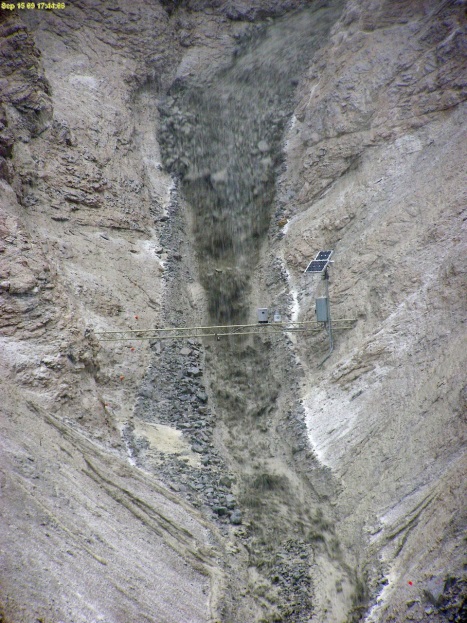
a debris flow
A debris flow more than a meter in depth rushes towards a monitoring station. United States Geological Survey image by Jeffrey Coe.
A debris flow is a dense slurry of water-saturated debris that moves down a valley and looks and behaves much like flowing concrete. Debris flows form when loose soil or rocks get saturated with water, become unstable, and move downhill. They can move as slowly as meters per year, or as quickly as hundreds of kilometres per hour. Debris flows tend to be diluted as they travel downstream, so what was a debris flow may become a flood further away from the volcano. Numerous debris flows have occurred at Mount Baker in the last century, all in the absence of eruptions.
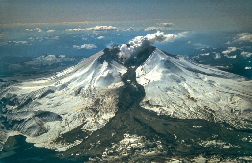
a lahar
Lahar deposit (dark material on the snow) from an eruption of Mount St. Helens, Washington in 1982. United States Geological Survey image by Tom Casadevall.
A lahar is a special type of debris flow or mudflow produced when volcanic materials interact with ice, snow, or surface water. During eruptions, snow and ice melted by hot volcanic debris can form large lahars, but lahars can also occur between eruptions when loose volcanic materials are eroded and carried away by water. Lahars are common at many stratovolcanoes, especially those with extensive snow and ice cover like Mount Baker. They may travel great distances via river drainages and can be extremely destructive.
The volume of ice on Mount Baker (about 1.8 cubic kilometres) is greater than that of all the other Cascades volcanoes, except Mount Rainier, combined. In an eruption, all of this snow and ice could melt and produce lahars. Because Mount Baker’s drainage system is so close to the Canadian border, lahars or flooding from an eruption could affect British Columbia in the area northwest of Mount Baker: a large lahar in the Nooksack River could cross a drainage divide at Everson, Washington and enter the Sumas River and, within hours, lead to flooding in the Abbotsford-Sumas Prairie area. In the past century, many floods caused by weather have crossed the drainage divide this way. However, lahars of this size occur only once every 14,000 years, and a weather flood is far more likely than a volcano-related flood. Precautionary methods for dealing with lahars are similar to those for dealing with floods. If a large lahar or flood did occur, pre-eruptive warning signs would give emergency personnel time to warn people in low-lying areas of the hazard
How might ash from a Mount Baker eruption affect Canada?
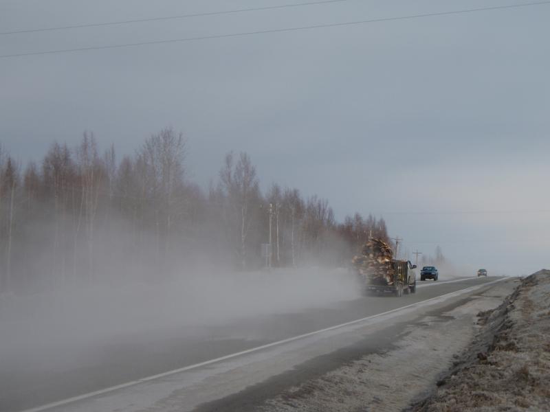
remobilized volcanic ash
Reduced visibility due to remobilized volcanic ash during a 2009 eruption of Redoubt volcano, Alaska. United States Geological Survey/ Alaska Volcano Observatory image by Kristi Wallace.
Explosive eruptions of Mount Baker that generate volcanic ash have been less frequent than at other Cascade volcanoes, but they still pose a potential hazard. A large explosive eruption is unlikely. Meteorological data indicate ash fallout from Mount Baker would most likely occur due east of the volcano, so the chance of any ash falling directly on Vancouver is extremely low. There is a much higher chance of ash falling in the eastern Fraser Valley. Fortunately, only a narrow area would likely be affected at any given time, and the overall probability of ash fall anywhere in British Columbia is still very low.
During an explosive eruption of Mount Baker, any ash that fell to the ground would damage machines, especially those requiring air filters, like cars, computers, and air conditioners. Some power distribution equipment might fail, resulting in power outages, and the ash might affect telephone service. Reduced visibility and accumulations of slippery ash on roads would make driving difficult and potentially more dangerous. Medical services might see an increase in the number of patients with respiratory and eye symptoms. Dust masks would be necessary where ash concentrations were high. Ash cleanup would be time-consuming. Air travel disruptions would be likely, even in areas where no ash was deposited on the ground, as was the case during the 2010 eruption of Eyafjallajökull in Iceland.
What is happening at Mount Baker today?
remobilized volcanic ash
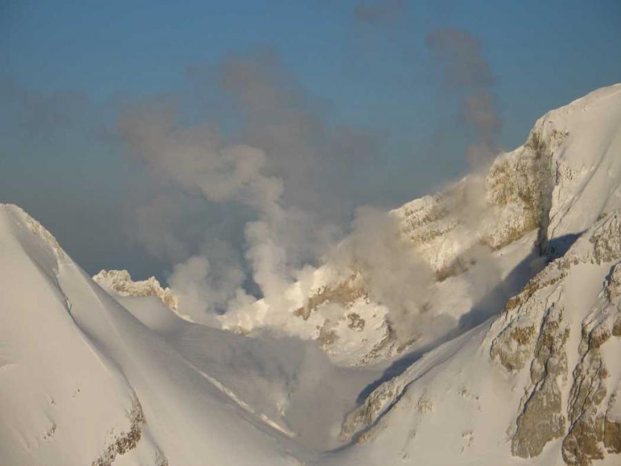
Fumaroles in Sherman Crater at Mount Baker, Washington. United States Geological Survey image by John Scurlock.
In 1975, activity increased at fumaroles (hot gas vents) in Mount Baker’s Sherman Crater, triggering concerns that an eruption might be imminent. In response, additional monitoring equipment was installed, and several geophysical surveys were conducted to try to detect the underground movement of magma. The level of Baker Lake was lowered, and access to the area was restricted due to concerns that an eruption-induced debris avalanche or debris flow might enter Baker Lake and displace enough water to either cause a wave to overtop the Upper Baker Dam, or cause failure of the dam. However, there were no signs (such as increased seismic activity) that indicated magma was moving up into the volcano.
Heightened fumarole activity has continued since the 1970s, but there are no other signs of renewed volcanism. Monitoring and research into the history, eruptive potential, and landslide hazard potential at Mount Baker are ongoing.
Will there be warnings before an eruption of Mount Baker?
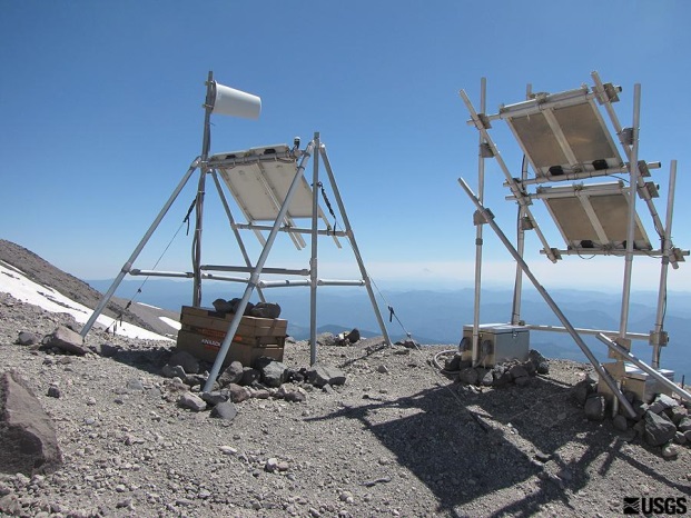
Seismic monitoring station
Seismic monitoring station at Mount St. Helens, with solar panels. United States Geological Survey image by A. Barsotti.
Most volcanic eruptions are preceded by days, weeks, months, or even years of warning signs, including many small earthquakes, ground deformation, and the release of volcanic gases (water vapour, sulphur dioxide, carbon dioxide, or other gases). Mount Baker is monitored by the Pacific Northwest Seismic Network, which receives continuous data from a network of seismometers in Washington and Oregon. The United States Geological Survey (USGS) Cascades Volcano Observatory also monitors volcanoes in this region. If there were signs of unrest at Mount Baker, additional seismic, ground deformation, and gas monitoring would be initiated.
The Mount Baker – Glacier Peak Coordination Plan serves as a blueprint for dealing with a volcanic eruption from Mount Baker or Glacier Peak, ensuring that emergency planning agencies in both the United States and Canada will have timely and accurate information before and during eruptions.
Preparation can help us to deal with any natural hazard event, and the preparations we make to deal with floods, earthquakes, and severe storms will be helpful if we ever have to deal with an eruption from Mount Baker or any other volcano. Mount Baker will eventually erupt again (perhaps not in our lifetimes), but a large eruption is unlikely without warning.